Tuesday, September 22, 2015

Day 24 - Monday, September 21 - Three Rivers, Sequoia Park, Big Bear Lake

Starting mileage:  6664 Starting time: 8:00 am

Ending mileage: 7049 Ending time: 8:00 pm
Travel mileage: 385   Travel time: 12 hours

One of the largest forest fires in California history has closed the northern part of Sequoia Park for several weeks but it has finally opened up today so that we can travel from the southern entrance along the Generals Highway to the north entrance.

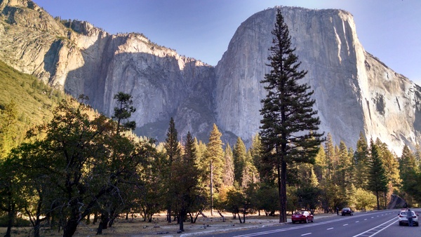
The drive up from Three Rivers to the Giant Forest Sequoia grove is a slow and very winding trip with many hair-pin turns. The view is a bit disconcerting if one looks at the sheer drop-offs at the side of the road. This grove is over 2200 acres and has many of the largest trees in the park. Nearly all of them have bases that have been scarred by fire but the thick bark protects the trees.

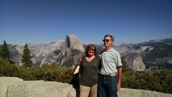
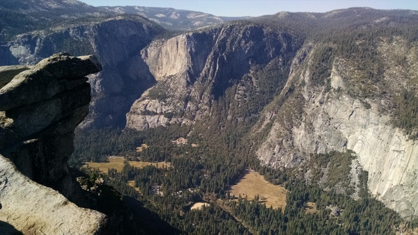
Our first stop was a walk up to the top of Moro Rock, a granite outcrop overlooking the valleys below. Fortunately, there are steps and handrails for the steep climb up to the top. It must have been much more exciting when John Muir and other adventurers climbed up here in the late 1800s. Unfortunately, the smoke from the fires to the north obscured the views to the distance.

We went for a short loop walk around the Crescent Meadow which John Muir called an "Eden" when he visited here. It is surrounded by many huge Sequoia trees. We were surprised to see a marmot charging towards us on the trail but it veered off when it realized we were on the trail.

There is a nice museum and visitor center for the Giant Forest grove. For many years, forest fire suppression had been aggressively pursued before foresters realized in the 1960s that this had completely stopped the sprouting of new Sequoia trees which require fire to open the cones and release the seeds. It had also resulted in the accumulation of debris which caused even more severe fires when they occurred. Now there are prescribed burns and fires which don't threaten buildings or special areas may be allowed to burn.

We traveled on to the Grant Grove near the north park entrance which was supposed to open this morning but we were waved past as the park officials decided at the last minute not to reopen this area due to smoke and fire-fighting personnel still in the area. This was a bit disappointing but at least we had a good experience at the earlier grove.

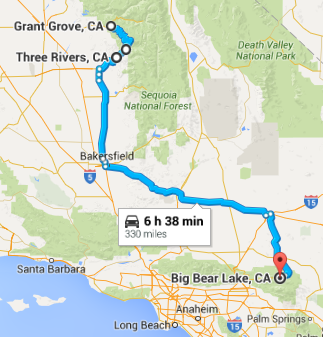
From here it was still a 300 mile drive to our hotel in the afternoon. Much of it was on the CA99 and CA58 freeways down the valley. Once again it was a largely agricultural area with huge expanses of citrus groves, vineyards, cotton and pistachios. By the time we got to Bakersfield, it was 105 degrees! From there we headed east - much of the trip was through the Mojave desert. 

When we came up through the Alta Pass, it was like a scene from Star Wars. As far as we could see, there were huge and smaller wind turbines. The smaller ones looked like lawn ornaments in comparison. This area is famous for being the first large wind power installation after the oil crisis of the 1970s. Unfortunately, this was also when scientists discovered large numbers of birds were being killed by the wind turbines which are positioned closely at 3 different heights and turn very quickly. The newer turbines are much larger, are spaced further apart and don't spin as quickly. This is the largest wind farm in the US.

It was getting dark by the time we approached the mountains surrounding Big Bear Lake and we enjoyed quite a spectacular sunset. The road up goes from 3000' to over 7000' with many switch-backs - it was an interesting drive in the dark. We didn't have to descend much as Big Bear Lake is at an elevation of 6700'. 

It had cooled down to 63 degrees by the time we got to the Best Western Big Bear Chateau. The rates for hotels here are very reasonable during the week and off-season. This area is a popular cool retreat in the summer and has a ski slope and other activities during the winter.

Day 24 route

Top of Moro Rock


By typical 2000 year old Sequoia


7000 miles into our trip


Wind turbines at Alta Pass


Sunset leaving Mojave desert


Sunday, September 20, 2015

Day 23 - Sunday, September 20 - Mariposa, Yosemite, Three Rivers

Starting mileage:  6435 Starting time: 7:30 am

Ending mileage: 6664 Ending time: 5:00 pm
Travel mileage: 229   Travel time: 9:30 hours

We left fairly early to get back to Yosemite before it got too crowded. While waiting for the light controlling the one-way section due to the rock slide we were interested by a crow that was walking down the road looking at the stopped cars for a handout which he/she didn't get from anyone.

We were rewarded by a great view of El Capitan in the morning light. There were so many spectacular views as we went up the valley to the Visitor Center. At one of our stops we were surprised by a mule deer that walked right behind me.  The Visitor Center has an interesting display of the geology and human history of the Yosemite region. Around noon we wound our way out though the southern entrance. 

In Oakhurst, the first major town outside the park, we stopped at Denny's for lunch but left in frustration as there were people waiting and nobody at the reception desk. We went to Katie's Kountry Kitchen a short distance down where we received a very friendly welcome, good service and tasty lunch. California also requires hamburgers to be cooked at least to "medium" (or beyond). It was nice to get a side salad instead of fries.

It was 100 degrees outside for the entire trip down to our hotel - we are very thankful for air conditioning! Unusually hot temperatures are forecast for several days.

We are staying at the Comfort Inn in Three Rivers, just outside the entrance to Sequoia National Park. Along the way, there is considerable agriculture with grapes, pistachios and citrus fruit. It is quite a contrast when you see where the irrigation ends. 


Day 23 route


We didn't talk politics with the guy in this pickup!

El Capitan at dawn

Carmen at Yosemite Valley


Mule deer


 Irrigated citrus grove


Saturday, September 19, 2015

Day 22 - Saturday, September 19 - San Jose, CA to Yosemite National Park

Starting mileage:  6167 Starting time: 9:00 am

Ending mileage:  6435 Ending time: 6:00 pm
Travel mileage:  268 Travel time: 9 hours

Traveling over the mountains east of Gilroy, we passed by the San Luis reservoir which is just about empty. The water was nearly down to the bottom of the dam and all that was left was the original small lake. The water has been down so long that the shallow shores have turned into a green meadow.

As we passed through the Joaquin Valley, there were numerous billboards with sayings like "Is growing food wasting water?" and informal signs saying "Pray for rain". This is a huge agricultural area with very rich soil. As we drove along, the crops progressed from peppers and tomatoes to cotton and grapes to almonds and pistachios. We were surprised to see grapes being grown in the same hot climate as cotton. The pistachio orchards suddenly stopped and we were back to dry grass - I wonder if this was where water for irrigation ended.

The terrain turned into rolling hills of obvious volcanic origin with boulders strewn around and jagged rock formations sticking up. The hills also became more populated with scrub oak trees which are tolerant of dry climates although they weren't looking good. This appears to be largely for cattle ranching as we could see the chutes for loading cattle into trucks. Sadly, there were "for sale" signs by many of the ranches and we didn't see any cattle. The signs for fire risk have the scale low, medium, high, severe and catastrophe - the arrow was pointing to catastrophe.

As we started the drive up into Yosemite, the temperature was 89 degrees. The hillsides became more green with pine trees although sadly, many of them are dying due to drought stress and the pine bark beetles. Our first main stop in the park was at Glacier Point which overlooks the Yosemite Valley thousands of feet below and Half Dome on the other side of the valley. The only words to describe it are "awe inspiring". The temperature had dropped to a comfortable 69 degrees. The downside is the huge crowds that have come to enjoy this awe-inspiring experience. On the way down there is an overlook with a spectacular view of the El Capitan on the left, the Yosemite Valley in the middle and Half Dome on the right.

Since we are planning on going back on Sunday to check out the Yosemite Valley, we made our way towards the hotel. Along the way, a huge rock slide has wiped out part of the road along the river, taking with it a large power transmission tower. Fortunately, they have been able to put temporary bridges across the river and pave an old trail on the other side wide enough for a single lane of traffic. Without this it would be at least a two-hour drive to get around.

Tonight we are staying at a Comfort Inn in the historic town of Mariposa which had considerable gold deposits and many prospectors around 1850.  We had a good and inexpensive dinner at a Mexican restaurant in town.

Day 22 route

David and Carmen at Glacier Point with Half Dome in the background


Yosemite Valley from Glacier Point

El Capitan and Yosemite Valley from overlook


Day 21 - Friday, September 18 - Work day at IBM Silicon Valley Lab

Since we were traveling down the length of California, it was relatively convenient to stop in at the lab to see Frank Butt, my new manager, and colleagues and get setup to work in the mainframe computer environment. It was a productive day and good to meet people who I've only worked with remotely. The lab here is located in a rural area on the south end of San Jose, surrounded by hills on the north with cattle grazing and fruit trees to the south. I used to come here frequently but hadn't been here since around 2002.

Carmen spent the day working on minutes for the Indian Lake Association and doing some shopping at the mall across the street.

We went out to dinner with Frank at a very authentic Chinese restaurant. Chinese TV was playing and we were the only Caucasians there. Frank ordered food which was very good although different from what we usually get.

Day 20 - Thursday, September 17 - Reno, NV, Lake Tahoe, San Jose, CA

Starting mileage:  5797 Starting time: 8:00 am

Ending mileage:  6137 Ending time: 8:00 pm
Travel mileage:  340 Travel time: 12 hours

It has been nice during this trip that we've been able to change our plans on the spur of the moment. We had planned today to travel to Lake Tahoe and then arrive fairly early in San Jose. While we were at Lake Tahoe, Carmen was "Googling" the history of mining in the area and we decided to go to Carson City, NV which wasn't that far away. This resulted in us crossing mountain passes through the Sierra Nevada three times in different places.

The scenic route from Reno to Lake Tahoe took us over the Mt. Rose pass at 8100', the highest year-round pass in the Sierra Nevadas. The view looking back towards Reno is quite spectacular. It was also chilly at only 37 degrees, the third time we've encountered this temperature at high elevations. Coming down the other side, the views of Lake Tahoe below are spectacular.

While traveling along the east shore of Lake Tahoe we stopped at a rest area where there are great views of the lake and a number of information plaques about the history of the region. Mining in Nevada required huge amounts of timber for shoring up the mines and fuel for steam-powered pumps. The nearest forests were around Lake Tahoe and 98% of the trees were cut in the 1850s and 1860s. It is hard to imagine all of the lumber being hauled up over the passes and down to the other side. Fortunately, the largest lumber baron wanted to save the environment for his descendants and protected the remaining old-growth forest and kept Lake Tahoe from being used as a water source for far away regions.

We took route 50 back over the mountains to Carson City. This is a 4-lane highway so the traveling was pretty quick, only taking 30 minutes. In Carson City we stopped at the Chamber of Commerce for maps and information. We decided to visit the Nevada State Museum which is in the old Carson City mint building. It was really a worthwhile visit. In the basement there is a replica of the gold and silver mines, illustrating the shoring and mining operations - I wouldn't have wanted to work in the mines! Upstairs there is a history of the settlement and geology and mineral exhibits. It is hard to keep track of the geology with volcanic activity, huge seas creating sedimentary rock, more volcanic activity and collisions of the tectonic plates forcing mountains up.

The main precious metal in Nevada was silver and the mint's operation depended on which political party in Washington was in power. The Democrats favored gold which resulted in the mint almost ceasing operation. The Republicans favored silver which resulted in the mint operating at full capacity. The mint was unusual as it handled the whole process from refining the silver and gold to producing coins. It finally ceased operation in 1893.

Our route from Carson City took us along the original Pony Express route of 1860-1861 which goes through the earliest settlement in Nevada in the 1840s where there is a quaint little town.

We crossed the mountains a third time over the Carson Pass at 8600'. By the time we got there it was mid-afternoon and the temperature was up to 60 under sunny skies. This follows the route used by Kit Carson and his party. It is extremely rugged with many bare rocky slopes although there are also high meadows and lakes above 7000'.

We didn't want to take the most efficient route to San Jose which would take us on the freeways around San Francisco at rush hour so we took I-5 down the valley east of the metropolitan area. This gives one a better feel for the importance of agriculture as we traveled around 50 miles with lush farms on both sides growing cherries, apples, strawberries and many other crops. These are all irrigated via aqueducts bringing water from a long distance. A lot of water must be lost through evaporation from the open aqueducts. Along with billboards asking people to conserve water there are billboards supporting the importance of agriculture. 

The hillsides are golden-brown with grass, almost no trees or other vegetation. Many areas were black from fire but at least these are easier to fight due to the low grass and easier access. There were also handmade signs in many places thanking the firefighters. 

Day 20 route


Reno valley from Mt. Rose pass

Lake Tahoe


Wednesday, September 16, 2015

Day 19 - Wednesday, September 16 - Redding, CA, Lassen Volcanic Park, Reno, NV

Starting mileage:  5475 Starting time: 8:00 am

Ending mileage: 5797 Ending time: 4:30 pm
Travel mileage: 322 Travel time: 8:30 hours

We left relatively early in the hope that we could get to Lassen but it was sprinkling already. Temperature dropped again as we went up in elevation from 59 degrees at the hotel to 37 degrees at Lassen. We are glad that the Adlers are bringing desperately needed rain to assuage the drought and many fires but it would be nice to get some nice weather when visiting the national parks.

From watching the national news about forest fires in the west it is impossible to appreciate the pervasiveness of forest fires out here. We are constantly passing through areas where the tree trunks are blackened from low-burning fires and areas that were completely decimated by fire and are recovering.

When we arrived at the north entrance to Lassen, the road through the park had just been closed due to snow. We were fortunately able to see Mt. Lassen while we were there. Instead of a 30 minute drive, we had a little over 2 hours drive to get to the southern entrance where we were able to visit the Sulphur Works where there are active hydrothermal vents and mud pots which were fascinating to see. There was regular rain which kept us from doing much walking on the trails.

We thought we might stay at Lake Tohoe tonight but it was difficult to find open and affordable accommodations so we ended up going to Reno and staying at a Days Inn here.

Once we got down to lower elevations in California and Nevada it was again very dry rangeland with sagebrush and dry grass. The road map shows Honey Lake as 10 mile by 10 mile blue area but when we went by didn't see anything but a large flat area with dust kicking up due to the wind. There were lush green fields that were being actively irrigated - we are always wondering how sustainable this is.

Day 19 route


Mount Lassen


Carmen with snow in the background at Sulphur Works


Tuesday, September 15, 2015

Day 18 - Tuesday, September 15 - Roseburg, OR, Crater Lake, Redding, CA

Starting mileage:  5176 Starting time: 8:00 am

Ending mileage: 5475 Ending time: 4:30 pm
Travel mileage: 299 Travel time: 8:30 hours

It was about 50 degrees and cloudy when we headed towards Crater Lake - by the time we got to the rim of the crater, it was a frigid 37 degrees at a little above 7000 feet. Once we descended back to the lowlands, it was nearly 60.

We took the scenic route along the north branch of the Umpqua river,a popular trout stream. It is just like in the movies, water tumbling over rocks and calm pools with fly fisherman casting their lures in a delicate motion. The sides are heavily wooded and the narrow road winds among huge hemlocks and Ponderosa pine.

We stopped at Clearwater Falls, a small but beautiful waterfall where the water tumbles over a relatively recent lava flow. The water comes from a spring fed by an aquifer formed by water percolating through the volcanic rock.

The road climbs steadily and as we approached the park we could smell and then see the smoke from the forest fire. The road was just opened a few days ago as the largest forest fire in park history has been mostly contained. Large areas along the road are blackened. In some areas the fire was mostly contained to the brush on the ground and singed the trees, turning all the needles brown but not burning them. In other places the fire went through the treetops just leaving blackened trunks. We could still see smoke rising in the distance where the fire is being fought.

It is hard to describe the feeling as one walks up to the crater rim at the first lookout, this immense caldera with sheer walls and a beautiful lake below. We didn't get to experience the famous blue color as it was overcast but it was spectacular nonetheless. A smaller volcanic cone rises about 800' in the lake. The lake is the deepest in the U.S. and the 9th deepest in the world, with a depth of just under 2000 feet. The mountain had been around 12,000 feet high before it had a major eruption 7700 years ago which caused the volcano to collapse into itself, dropping 4000' in height and another 2000' into the caldera. It didn't blow up like Mt. St. Helens. It also spewed out pumice to a depth of 300' and these areas are still barren due to porosity and lack of nutrients. 

We drove around the rim stopping at overlooks that all had spectacular views. It was too cold to eat outside so we had our lunch of cheese, crackers and fruit upstairs in the visitor center looking out over the lake - very nice.

On the way back down, we stopped to watch a red fox looking for food right at the edge of the road. A little further down we spotted two female elk by the side of the road.

Back down we were again in dry dry rangeland with dry grass and sagebrush. We shortly crossed into California where we could see dense smoke coming over the mountains on the left and filling the sky above us. The terrain levelled out and many areas are bright green where irrigated, growing large fields of strawberries and alfalfa. We wondered if this is one of the areas that is depleting the underground water supply.

There was a heavy rain for about 20 minutes - hopefully some of it was also in the areas that are burning. We passed by hills that were actively smoking although didn't se any flames. There are many areas where one can see signs of previous forest fires with varying degres of recovery. We are passing about 15 miles from Mount Shasta but no sign of it. 

Just before our hotel we passed by Shasta Lake, the largest reservoir in California.  It looks unreal, with a "bathtub ring" that is about 100 feet high and the water hundreds of feet from the shore. Businesses are building new roads to get down to the water level.  It is just as has been highlighted on the national news.

We should probably be more adventurous and try local roadside accommodations but it is so much easier to click on the app on the phone to see what is available at our destinations. We are having an early stop tonight at a Comfort Inn in Redding, CA, about an hour from Lassen National Park, our next destination.


So far the gas has been cheapest in Oregon at $2.39 a gallon. Once we crossed into California, it was $2.99 a gallon.


Day 18 route


Clearwater Falls


Crater Lake entrance with burned trees


Crater Lake from north rim


Carmen at south rim of Crater Lake