Wednesday, September 30, 2015

Day 33 - Wednesday, Sept 30 - Los Alamos to La Junta, CO

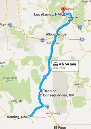
Starting mileage:  8360  Starting time: 9:30 am

Ending mileage: 8634 Ending time: 4:30 pm
Travel mileage:  274 Travel time: 7:00 hours

It was such a relief to have cooler temperatures again, about 60 this morning.

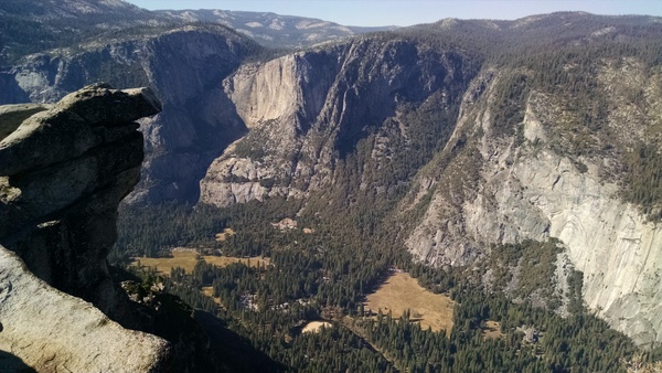
The sheer cliffs at the edge of the mesa that Los Alamos are just spectacular. Much of the volcanic rock is soft and birds have dug nests into the side. On the way down we could see heavy smoke filling much of the valley north of Santa Fe - prescribed burns are being done to reduce the chance of large out of control fires.  4 years ago there was a huge fire on the mountains above Los Alamos which required the lab and most of the residences to be evacuated. The hills are just starting to come back with new growth.

We decided to take the route north through Taos which is on the plain above the Rio Grande. Although the river isn't large in this area, it has cut a gorge hundreds of feet deep - quite spectacular cut into an absolutely flat plain. We thought we would look around historic Taos but after 20 minutes inching along in traffic, decided to head out towards Colorado without stopping.

As we were turning off I-25 in Trinidad, CO, the sky was absolutely black in front of us with occasional lightening. All of a sudden we had zero visibility in gale force winds, torrential rain and heavy hail about the size of marbles. We quickly pulled onto the shoulder and stopped. The temperature dropped 30 degrees in less than 5 minutes, from 79 to 49. We were concerned that the hail might damage the windows but fortunately, it didn't - our windshield was very clean however. The storm only lasted about 10 minutes and then moved on.

On the road to La Junta, we saw 4 tarantulas crossing the road. We stopped and I tried to take a photo but it didn't turn out that well among the grass on the shoulder. I picked it up with a stick but it didn't wan't to be photographed and it jumped off. They are quite impressive to see. This is the mating season and the males are out looking for a good time.

We also saw a number of herds of antelope but didn't get close enough to take a photo. Ironically, one of the herds was right next to the NRA headquarters.

We are staying at an Econolodge in La Junta, CO - it is pretty basic but the price was right as we can use our "points" for a free stay tonight.

Day 33 route


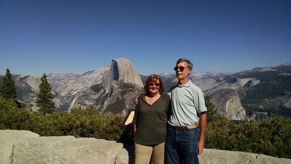
Andy, Marguerite and Carmen in Los Alamos


Cliffs along the mesa
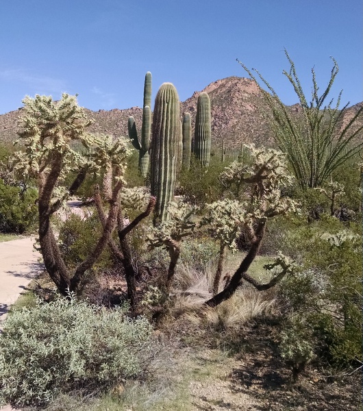

Furry friend


Day 32 - Tuesday, Sept 29 - Deming, NM to Los Alamos, NM

Starting mileage:  8016  Starting time: 9:30 am

Ending mileage: 8360  Ending time: 4:00 pm
Travel mileage:  344 Travel time: 6:30 hours

Today was mostly a traveling day to visit our friends Andy and Marguerite in Los Alamos. Andy was my roommate at Princeton and is now a research scientist at the Los Alamos Laboratory.

Our trip took us through Hatch, NM which claims to be the chili pepper capital of NM. It is a small town but everywhere there are red peppers drying on metal roofs and long strings of dried peppers hanging in front of shops. 

This is also where we crossed the Rio Grande although it isn't very "grand". Due to all the dams and water diversion upstream, it wasn't any bigger than the Esopus near our house, only about 100' across.

We made a short stop in Truth or Consequences, NM to see if there was anything interesting. It was renamed in 1950 after the radio show host Ralph Edwards said he would broadcast from the first town to rename itself - and the name has been kept since then. The town was originally named "Hot Springs" and still has historic resorts and spas from the late 1800s. There is a fountain that is said to shoot up hot water every 15 minutes but we didn't wait for it.

I-25 follows the Rio Grande valley all of the way up to Santa Fe. There are towns and green vegetation along both sides of the river although it quickly becomes brown past the watered areas.

Our first stop in Los Alamos was Rose Chocolatier, Marguerite's artisan chocolate shop which she opened a little over a year ago. Andy stopped by on his way back from the lab and gave us a short walking tour of the town.  The county historical museum is located in a building which was a private boarding school up until 1940 when the Manhattan Project was established here and it was taken over by the government for offices and meeting rooms.

Andy and Marguerite have a house on the edge of the mesa with quite a spectacular view of the canyons and the mountains in the distance towards Santa Fe. It is quite a steep drop from the edge of their property to the bottom of the canyon. We were here 4 years ago for their wedding which was held in their yard.

Day 32 route


Rio Grande valley near Albuquerque 


'


\

Tuesday, September 29, 2015

Day 31 - Monday, Sept 28 - Gila Bend, Tucson, Deming, NM

Starting mileage:  7611 Starting time: 7:45 am

Ending mileage: 8016  Ending time: 7:45 pm
Travel mileage:  405 Travel time: 12 hours

At breakfast we were talking to our waitress and was surprised that she had moved from San Diego to Gila Bend. Gila Bend is ridiculously and looks like it is dying with many boarded up store fronts. She said that her car broke down while driving through and had to be repaired. She became friends with the mechanic who turned into the "love of her life". She decided to stay, married him and has a 8 month year-old son!

The Sonoran Desert National Monument started just after leaving Gila Bend. The terrain is again very rocky with scrub, rolling hills and some mountains. We soon started seeing Saguaro cactus along both sides of the road which went on for miles. Then suddenly we didn't see them anymore although the terrain had not changed noticeably. Then after another 10 miles or so we started to see them again.

On the way to the Saguaro National Park we were surprised to see signs warning of flooding on the road and also signs warning of slippery when icy - it seemed incongruous with the temperature approaching 100 and the ground absolutely parched.  

Approaching the park, the number of Saguaro increase and numerous other varieties of cactus also appear, prickly pear, barrel, cholla. It is quite a change and very spectacular.

At the park visitor center there is a visual showing how the ground water level has dropped by 250' between 1900 and 1980. It stopped there and we wondered where it was now.  We also noticed in the distance what looked like a number of square lakes in the valley. When we asked one of the park staff about this, he said that those are ponds that are being used to recharge the aquifer, using water that comes from the Colorado river as part of Arizona's allocation. This has been successful, with the ground water level rising. He also added that this is still a problem because it is dependent on a scarce resource.

There is a nice short trail around the visitor center that identifies the different cactus and other desert plant species that we see. 

Just outside the park is the Desert Museum which we went in. Most of it is outside where there are trails through different types of habitat.  Many of the desert animals are there although we weren't able to see many of them - we suspect that in the mid-day heat most of them were resting in shade that they could find. There was an apiary where we could see a number of the bird species found in the desert. We would have liked to stay longer but it was unbearably hot, 101 degrees in the shade, and there wasn't much shade.  We also still had over 3 hours to get to our hotel, even with a speed limit of 75 all the way.

In New Mexico we went over the continental divide again but it was a bit of a disappointment, just a sign on a relatively flat section of I-10. When we crossed the divide in the Canadian Rockies, it was much more obvious.

The gas prices have dropped considerably since leaving California. It was $2.14 in Tucson and $2.08 in Deming, NM. In California it was a challenge to find gas for less than $3/gallon.

We are staying at a Holiday Inn Express in Deming. When we looked for a restaurant, most of them were familiar chains: Denny's, IHOP, KFC, Carl Jr, BK, etc. We finally found the Rancher's Grill which was a local restaurant.

Day 31 route

Entering Sonora National Park

Various cactus


Sunday, September 27, 2015

Day 30 - Sunday, September 27 - San Diego to Gila Bend, AZ

Starting mileage:  7350 Starting time: 10:30 am

Ending mileage:  7611 Ending time: 5:00 pm
Travel mileage:  261 Travel time: 6:30 hours

We are on our way home. It was hard to say goodbye but we plan to be back at Christmas.

It was another hot temperatures - 106 in California and 108 as we passed into Arizona.

We are still amazed at all the agriculture in the desert. We passed some newly planted (we assume - just looked like desert) fields that were being irrigated. A lot of water must evaporate when it is being sprayed into the air at mid-day when it is 108 degrees. There were some large cattle feed lots and it looked like they were growing hay for feed.

We passed through an area of mountains that were covered with large round boulders. We thought of a science fiction movie where the boulders suddenly come alive as strange "stone" beasts.

It is good to see renewable energy being exploited. Near El Centro there was another huge farm of large wind turbines. A little further along there were several acres of photo-voltaic arrays owned by Duke Power that looked like they were turning to always face the sun. Unfortunately, it looked like some of the mechanisms weren't working as they weren't all pointing in the same direction. 

We didn't even notice we had crossed the Colorado River when we entered Arizona. There is so little water in the river by the time it gets here, it is only about 100' wide. In the early 1900s it used to be a raging river that sometimes flooded 15 miles wide. The Hoover dam, other dams down river and diversion of water for irrigation have reduced the flow to a trickle. After Mexico takes its share of water, there is nothing left by the time it enters the Gulf of Mexico.

We stopped in Yuma for lunch at Subway and afterwards went to the Yuma Territorial State Park which was quite interesting. This was a prison from 1876 to 1909 and parts of it have been maintained as a historic site along with a museum constructed on the grounds.  The Yuma townspeople thought the prison was a luxury with bathtubs, showers, a library and a hospital. The inmates thought it was a hellhole, 6 to a tiny vermin-infested cell with temperatures often over 100. They also had to do hard work outside in the heat. There were many interesting histories of inmates, why they were there, how they tried to escape, etc.

Near Gila Bend, AZ we passed the Solana parabolic concentrating solar power system that uses over 1900 acres of collectors. The parabolic mirrors focus heat on tubes of molten salt which can be stored and later be used to produce steam to drive turbines to generate electricity. This allows the generation of electricity in the evening when the sun isn't shining.

We are staying at the "Space Age Lodg" Best Western in Gila Bend. It was created by a former NASA engineer. The rooms all have space shuttle and other NASA photos. The outside is glittery. We had a very authentic Mexican dinner in a little hole in the wall restaurant down the road.

We were also able to watch the lunar eclipse of the "super" moon. No worry about clouds here!

Day 30 route


Saying goodbye to Anna this morning

Strange boulder formations

Colorado river in Yuma (foreground)

Yuma prison state park - guard tower and water storage


Saturday, September 26, 2015

Day 29 - Saturday, September 26 - In San Diego

Hanging out with Anna today.

Anna and Bella at the bank

Street Market in "Normal" San Diego neighborhood


Dinner at Sushi Ota


Day 28 - Friday, September 26 - in San Diego

We've traveled over 7000 miles at this point so I had the tires rotated in the morning at Tire Express which had good ratings on Yelp. It was a bit strange, an alley with used tires on both sides and a bunch of guys using jacks to raise up cars for tire work. The price was good and job was fine. I also took Anna's car in to have tires swapped and aired up - every time we come out, Anna's low tire pressure light is on.

We had lunch at the Blue Water fish market and restaurant which has delicious seafood. We had "ahi poke" which is like an ahi sashimi salad as an appetizer. I had wasabi sesame crusted grilled ahi salad which was delicious. The ahi was buttery soft. See photo below.

On the way back, Anna dropped me of at Floyd's barbershop as I was in need of a haircut after 4 weeks on the road. I hope Joe at Hair Design in Kingston forgives me but I couldn't wait until after we get back from Maine in another 3 weeks.

In the afternoon we went to see "The Intern" with Ann Hathaway and Robert de Niro - it was very funny and a good way to get away from the afternoon heat. The last few days have been very hot for this time of year, mid-80s.

Dinner was a bit unusual. Whole Foods has a bar by the entrance where one can get 32 different beer on tap. We got Chinese takeout food at Whole Foods and ate it at the bar. It is surprisingly dog friendly - Anna was able to bring her dog Bella into the bar while we had dinner. San Diego is very dog friendly but it was surprising that this was OK in a supermarket.

Not sure that all this is very interesting.

Wasabi sesami crusted seared Ahi salad with Ahi poke side


Friday, September 25, 2015

Day 27 - Thursday, September 24 - In San Diego

Our time in San Diego is mostly relaxing, eating and family time.

We got up late and had lunch at the Brockton Villa, a restaurant in a historic house overlooking La Jolla Cove. This was built in 1894 as a weekend retreat - at that time it took 4 hours to get from downtown San Diego. Now it takes about 20 minutes. From the veranda we could hear the sea lions in the cove barking. I had the "Coast Toast", french toast that Brocton Villa is famous for - it is thick slices of french bread that is creamy on the inside and crunchy on the outside, served with boysenberry jam and maple syrup.

It was hot and sunny, a perfect day to be out on the water. I rented a kayak at La Jolla shores, something I had done a few times on other trips to San Diego. The ocean was relatively calm with long rollers about 3' high. I kayaked out to the kelp beds about a mile out where one can sometimes see interesting fish and sea lions. Didn't find anything interesting but a few years ago when I went out with Amy, a sea lion went back and forth underneath our kayaks which was pretty exciting. On the way back, I went by the La Jolla caves, deeply eroded sections of steep sandstone banks. In order to go through the caves one must be with a guide so I didn't go in. One needs to be careful going near the edge as many cormorants and sea gulls are along the overhangs and one can get blessed with bird droppings.

Anna's apartment is in the Hillcrest neighborhood of San Diego which has dozens of restaurants of all ethnicities. It would take quite a while to try them all although we are trying... We went to Salt and Cleaver on 5th avenue. I had a beer braised bratwurst which turned out to actually be Italian hot sausage - oh well.

                                                                  La Jolla Cove


David coming in from Kayaking


Wednesday, September 23, 2015

Day 26 - Wednesday, September 23 - Pasadena to San Diego

Starting mileage:  7181 Starting time: 9:00 am

Ending mileage: 7181 Ending time: 4:00 pm
Travel mileage: 132   Travel time: 7 hours

We had a very nice breakfast with our niece Surana at Le Pain Quotidien, an organic bakery and restaurant in Pasadena.

We had planned to visit the Huntington Library and Botanic Garden but when we got there, learned that it didn't open until noon during the week and we didn't want to wait an hour and a half. We also wanted to leave Pasadena between 1 and 2 so that we didn't get stuck in San Diego rush hour traffic.

Instead, we went to the L.A. Arboretum which was just a few miles away. This is also very pleasant and interesting. It was getting hot, 90 degrees, and after walking around for a while, decided to leave for San Diego.

It is hard to fathom the gas prices. In Pasadena, gas was around $3.39 which was higher than in some of the remote areas we were in. We bought gas on the way to San Diego for only $2.89. Coincidentally, this was where Anna's car battery died on the way back from her graduation a year ago and I had to jump-start it by letting it roll backwards and popping the clutch before it backed into something. Fortunately it started and we got a new battery at Wal-Mart.

The traffic wasn't bad and we moved along at 75, getting to the Days Hotel a little before 3pm, too early for check-in at 4pm. It is cooler in San Diego, around 80. We had lunch at a restaurant a few blocks down and were able to check when we finished. This will be our home for the next 4 days while we visit with Anna.

Day 26 route

With Surana in Pasadena


 L.A. Arboretum


Day 25 - Tuesday, September 22 - Big Bear Lake to Pasadena

Starting mileage:  7049 Starting time: 9:00 am

Ending mileage: 7181 Ending time: 4:00 pm
Travel mileage: 132   Travel time: 7 hours

Tuesday was a pretty easy day - nice to drive less and relax more.

We had wanted to visit the Discovery Center in Big Bear Lake but it is closed on Tuesday and Wednesday. We drove around the lake which is very low. One person we spoke to said that it was 18' below the top of the dam and the marina had to move the boat slips out pas the breakwater.

We decided to take the scenic route down which goes up over an 8400' pass. There were signs along the road warning of flooding from a few days ago but it was very dry now. The fire danger is still "extreme".

We had hoped to visit our friends the Cadys in Yucaipa but we weren't able to plan in advance and they were away. We did have great chef's and Cobb salads at the Kopper Kettle Kafe in Yucaipa.

Since we were so close to Redlands, I called my former (and now current) Esri colleagues to see if they were available and fortunately was able to visit with Donna and Neeta at the Esri headquarters. It was nice to see them.

From there it as a short trip to the Comfort Inn (free tonight with loyalty points). Arriving early, we went in the pool and got caught up with laundry.

Day 25 route


Tuesday, September 22, 2015

Day 24 - Monday, September 21 - Three Rivers, Sequoia Park, Big Bear Lake

Starting mileage:  6664 Starting time: 8:00 am

Ending mileage: 7049 Ending time: 8:00 pm
Travel mileage: 385   Travel time: 12 hours

One of the largest forest fires in California history has closed the northern part of Sequoia Park for several weeks but it has finally opened up today so that we can travel from the southern entrance along the Generals Highway to the north entrance.

The drive up from Three Rivers to the Giant Forest Sequoia grove is a slow and very winding trip with many hair-pin turns. The view is a bit disconcerting if one looks at the sheer drop-offs at the side of the road. This grove is over 2200 acres and has many of the largest trees in the park. Nearly all of them have bases that have been scarred by fire but the thick bark protects the trees.

Our first stop was a walk up to the top of Moro Rock, a granite outcrop overlooking the valleys below. Fortunately, there are steps and handrails for the steep climb up to the top. It must have been much more exciting when John Muir and other adventurers climbed up here in the late 1800s. Unfortunately, the smoke from the fires to the north obscured the views to the distance.

We went for a short loop walk around the Crescent Meadow which John Muir called an "Eden" when he visited here. It is surrounded by many huge Sequoia trees. We were surprised to see a marmot charging towards us on the trail but it veered off when it realized we were on the trail.

There is a nice museum and visitor center for the Giant Forest grove. For many years, forest fire suppression had been aggressively pursued before foresters realized in the 1960s that this had completely stopped the sprouting of new Sequoia trees which require fire to open the cones and release the seeds. It had also resulted in the accumulation of debris which caused even more severe fires when they occurred. Now there are prescribed burns and fires which don't threaten buildings or special areas may be allowed to burn.

We traveled on to the Grant Grove near the north park entrance which was supposed to open this morning but we were waved past as the park officials decided at the last minute not to reopen this area due to smoke and fire-fighting personnel still in the area. This was a bit disappointing but at least we had a good experience at the earlier grove.

From here it was still a 300 mile drive to our hotel in the afternoon. Much of it was on the CA99 and CA58 freeways down the valley. Once again it was a largely agricultural area with huge expanses of citrus groves, vineyards, cotton and pistachios. By the time we got to Bakersfield, it was 105 degrees! From there we headed east - much of the trip was through the Mojave desert. 

When we came up through the Alta Pass, it was like a scene from Star Wars. As far as we could see, there were huge and smaller wind turbines. The smaller ones looked like lawn ornaments in comparison. This area is famous for being the first large wind power installation after the oil crisis of the 1970s. Unfortunately, this was also when scientists discovered large numbers of birds were being killed by the wind turbines which are positioned closely at 3 different heights and turn very quickly. The newer turbines are much larger, are spaced further apart and don't spin as quickly. This is the largest wind farm in the US.

It was getting dark by the time we approached the mountains surrounding Big Bear Lake and we enjoyed quite a spectacular sunset. The road up goes from 3000' to over 7000' with many switch-backs - it was an interesting drive in the dark. We didn't have to descend much as Big Bear Lake is at an elevation of 6700'. 

It had cooled down to 63 degrees by the time we got to the Best Western Big Bear Chateau. The rates for hotels here are very reasonable during the week and off-season. This area is a popular cool retreat in the summer and has a ski slope and other activities during the winter.

Day 24 route

Top of Moro Rock


By typical 2000 year old Sequoia


7000 miles into our trip


Wind turbines at Alta Pass


Sunset leaving Mojave desert


Sunday, September 20, 2015

Day 23 - Sunday, September 20 - Mariposa, Yosemite, Three Rivers

Starting mileage:  6435 Starting time: 7:30 am

Ending mileage: 6664 Ending time: 5:00 pm
Travel mileage: 229   Travel time: 9:30 hours

We left fairly early to get back to Yosemite before it got too crowded. While waiting for the light controlling the one-way section due to the rock slide we were interested by a crow that was walking down the road looking at the stopped cars for a handout which he/she didn't get from anyone.

We were rewarded by a great view of El Capitan in the morning light. There were so many spectacular views as we went up the valley to the Visitor Center. At one of our stops we were surprised by a mule deer that walked right behind me.  The Visitor Center has an interesting display of the geology and human history of the Yosemite region. Around noon we wound our way out though the southern entrance. 

In Oakhurst, the first major town outside the park, we stopped at Denny's for lunch but left in frustration as there were people waiting and nobody at the reception desk. We went to Katie's Kountry Kitchen a short distance down where we received a very friendly welcome, good service and tasty lunch. California also requires hamburgers to be cooked at least to "medium" (or beyond). It was nice to get a side salad instead of fries.

It was 100 degrees outside for the entire trip down to our hotel - we are very thankful for air conditioning! Unusually hot temperatures are forecast for several days.

We are staying at the Comfort Inn in Three Rivers, just outside the entrance to Sequoia National Park. Along the way, there is considerable agriculture with grapes, pistachios and citrus fruit. It is quite a contrast when you see where the irrigation ends. 


Day 23 route


We didn't talk politics with the guy in this pickup!

El Capitan at dawn

Carmen at Yosemite Valley


Mule deer


 Irrigated citrus grove


Saturday, September 19, 2015

Day 22 - Saturday, September 19 - San Jose, CA to Yosemite National Park

Starting mileage:  6167 Starting time: 9:00 am

Ending mileage:  6435 Ending time: 6:00 pm
Travel mileage:  268 Travel time: 9 hours

Traveling over the mountains east of Gilroy, we passed by the San Luis reservoir which is just about empty. The water was nearly down to the bottom of the dam and all that was left was the original small lake. The water has been down so long that the shallow shores have turned into a green meadow.

As we passed through the Joaquin Valley, there were numerous billboards with sayings like "Is growing food wasting water?" and informal signs saying "Pray for rain". This is a huge agricultural area with very rich soil. As we drove along, the crops progressed from peppers and tomatoes to cotton and grapes to almonds and pistachios. We were surprised to see grapes being grown in the same hot climate as cotton. The pistachio orchards suddenly stopped and we were back to dry grass - I wonder if this was where water for irrigation ended.

The terrain turned into rolling hills of obvious volcanic origin with boulders strewn around and jagged rock formations sticking up. The hills also became more populated with scrub oak trees which are tolerant of dry climates although they weren't looking good. This appears to be largely for cattle ranching as we could see the chutes for loading cattle into trucks. Sadly, there were "for sale" signs by many of the ranches and we didn't see any cattle. The signs for fire risk have the scale low, medium, high, severe and catastrophe - the arrow was pointing to catastrophe.

As we started the drive up into Yosemite, the temperature was 89 degrees. The hillsides became more green with pine trees although sadly, many of them are dying due to drought stress and the pine bark beetles. Our first main stop in the park was at Glacier Point which overlooks the Yosemite Valley thousands of feet below and Half Dome on the other side of the valley. The only words to describe it are "awe inspiring". The temperature had dropped to a comfortable 69 degrees. The downside is the huge crowds that have come to enjoy this awe-inspiring experience. On the way down there is an overlook with a spectacular view of the El Capitan on the left, the Yosemite Valley in the middle and Half Dome on the right.

Since we are planning on going back on Sunday to check out the Yosemite Valley, we made our way towards the hotel. Along the way, a huge rock slide has wiped out part of the road along the river, taking with it a large power transmission tower. Fortunately, they have been able to put temporary bridges across the river and pave an old trail on the other side wide enough for a single lane of traffic. Without this it would be at least a two-hour drive to get around.

Tonight we are staying at a Comfort Inn in the historic town of Mariposa which had considerable gold deposits and many prospectors around 1850.  We had a good and inexpensive dinner at a Mexican restaurant in town.

Day 22 route

David and Carmen at Glacier Point with Half Dome in the background


Yosemite Valley from Glacier Point

El Capitan and Yosemite Valley from overlook