We were able to check off quite a few places that were on our "bucket" list:
- Travel across Canada to the west coast, driving above Lake Superior
- Glacier National Park (would have liked better weather for the drive over the "Going to the Sun highway)
- Banff and Jasper National Parks, especially walking out on the glacier
- Victoria, BC and Butchart Gardens
- Crater Lake National Park
- Lassen National Park
- Yosemite National Park
- Sequoia National Park
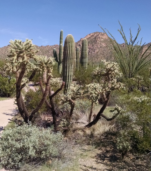
- Saguaro National Park
- Capilano swinging bridge park in Vancouver
- Alberta dinosaur provincial park
- Yuma territorial prison museum
- Dodge City Boot Hill Museum
- Lincoln home and tomb in Springfield, IL
- Mark Twain home in Hannibal, MO
Our trip also impressed on us how much land is used for agriculture, from Manitoba and Saskatchewan in Canada to California, Arizona, New Mexico and the rest of the way back to Ohio. We certainly wondered how sustainable it is to do intensive irrigation in desert areas. There were huge feedlots in Arizona and New Mexico with thousands of cattle that were surrounded by hay fields that were only possible through irrigation. Farm organizations had put up billboards highlighting the importance of water for farming yet in many places we saw water being used inefficiently, sprayed into the air at mid-day with 100+ degree temperatures.
Traveling through the west gave us a much better perspective of the pervasiveness of forest fires. From Alberta through Washington, Oregon and California we often encountered areas that had recently burned and could smell the smoke. Parts of Sequoia park were closed due to the active fires and visibility was very low.
All of our electronic gadgets simplify travel. With the car GPS we just plug in a destination address and don't really need a paper map anymore although it is often a good double-check as the GPS sometimes makes poor decisions on the route.
When planning our travel for the day, we would use Google Maps to estimate the time to various destinations and decide how many hours we wanted to drive each day.
Using the TripAdvisor app on my phone, we would check the hotels and their prices at our next destination and then use the hotel chain app to make the actual reservation in order to get our "loyalty points". It was a bit disconcerting to see how room prices changed dynamically. Sometimes after making a reservation, I would go back to check room prices and often just a few minutes later the cost of the same room would be significantly higher. Sometimes prices increased as the arrival date was closer and sometimes the prices decreased as the hotel wanted to fill empty rooms. It would be interesting to know how to optimize this for our benefit.
We also used TripAdvisor to locate restaurants near where we were staying, checking the reviews for service and quality.
One of the apps that we enjoyed was the Banff GyPSy tour app by "GPS Tour Guide" that was like having our own personal tour guide as we drove. It was very accurate and would make suggestions like "look at the lake on the left that you are passing now" or "see the fire damage on the right". It also suggested stopping at some very interesting points that we would have bypassed on our own.
All of the hotels we stayed in had free WiFi although the quality varied considerably. At least it was enough to keep up on e-mail and work on our blog.
We are already planning our next road trip, probably down the east coast to Key West in the spring. We want to visit places like the Blue Ridge Highway, Smokey Mtn Park, Monticello, Savannah.